HELENE
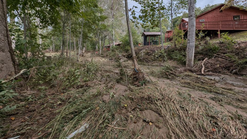
Biblical, catastrophic, never-before-seen. These are the descriptors we are using to put into words the impact Helene left on our region. It is Thursday, Oct 3rd and we are still unpacking the worst, with limited cell signal across the region, wifi in spots (using my work wifi to get this out) and low supplies of gas and water.
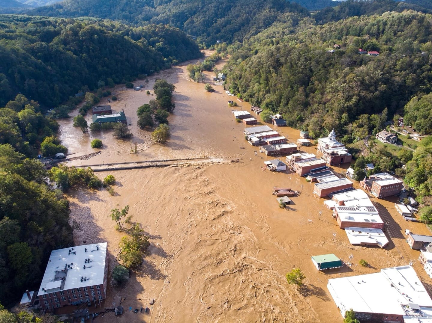
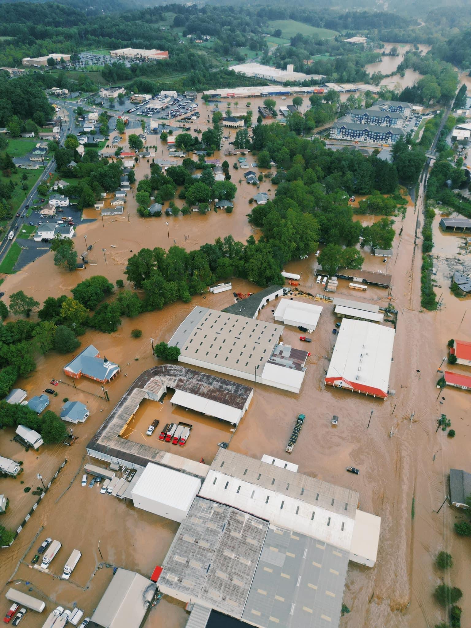
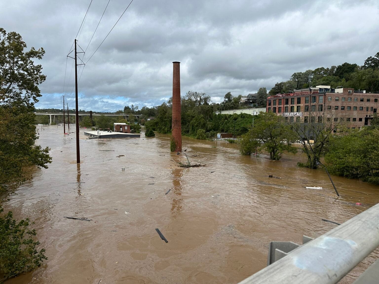
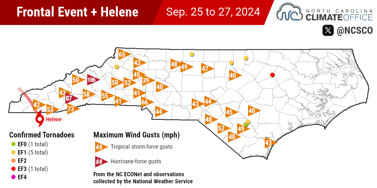
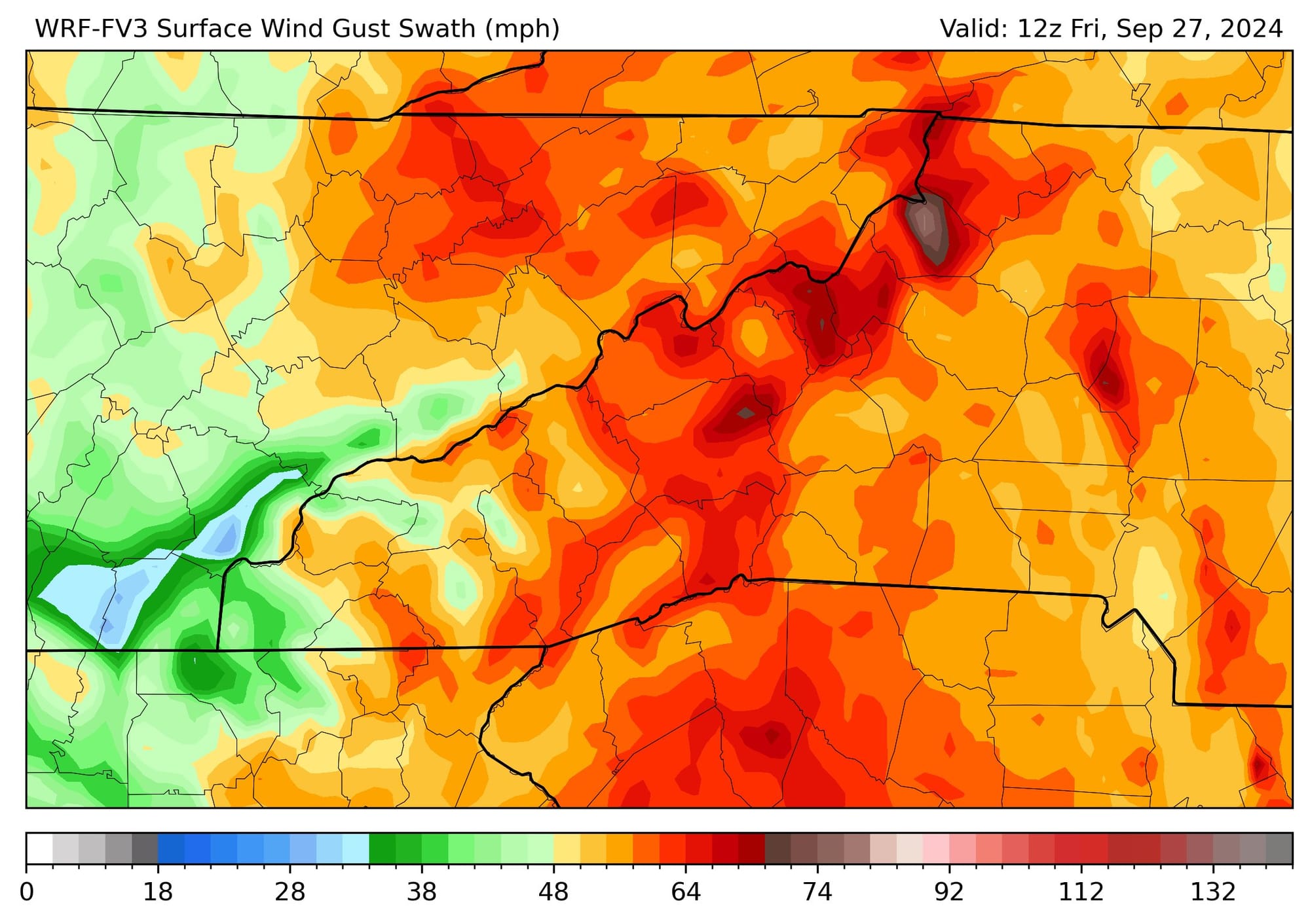
Helene was historic and record breaking in almost all regards. River crest heights, one-day, two-day and storm total rainfall amounts, gust wind speeds, and the fallout from it all; no comms, roads/water just gone in areas.
Rainfall Totals
will update once NWS report is finalized around 10/8
- 31.33" in Busick
- 24.41" on Mt Mitchell
- 24.12" in Spruce Pine
- 22.36" in Foscoe
- 22.12" in Black Mtn
- 21.96" south of Hendersonville
- 12.93" in Waynesville
Highest Wind Speeds
- 106 mph on Mt Mitchell
- 87 mph on Frying Pan Tower
- 74 mph on Poga Mtn (Avery)
- 60 mph in Newland
- 53 mph in Highlands
- 46 mph in Asheville
What led to this historic flooding is a setup we have seen before in WNC. Frances setting up Ivan in 2004, the round of rain prior to TS Fred in 2019 and this go-around we had a PRE (Predecessor Rain Event).
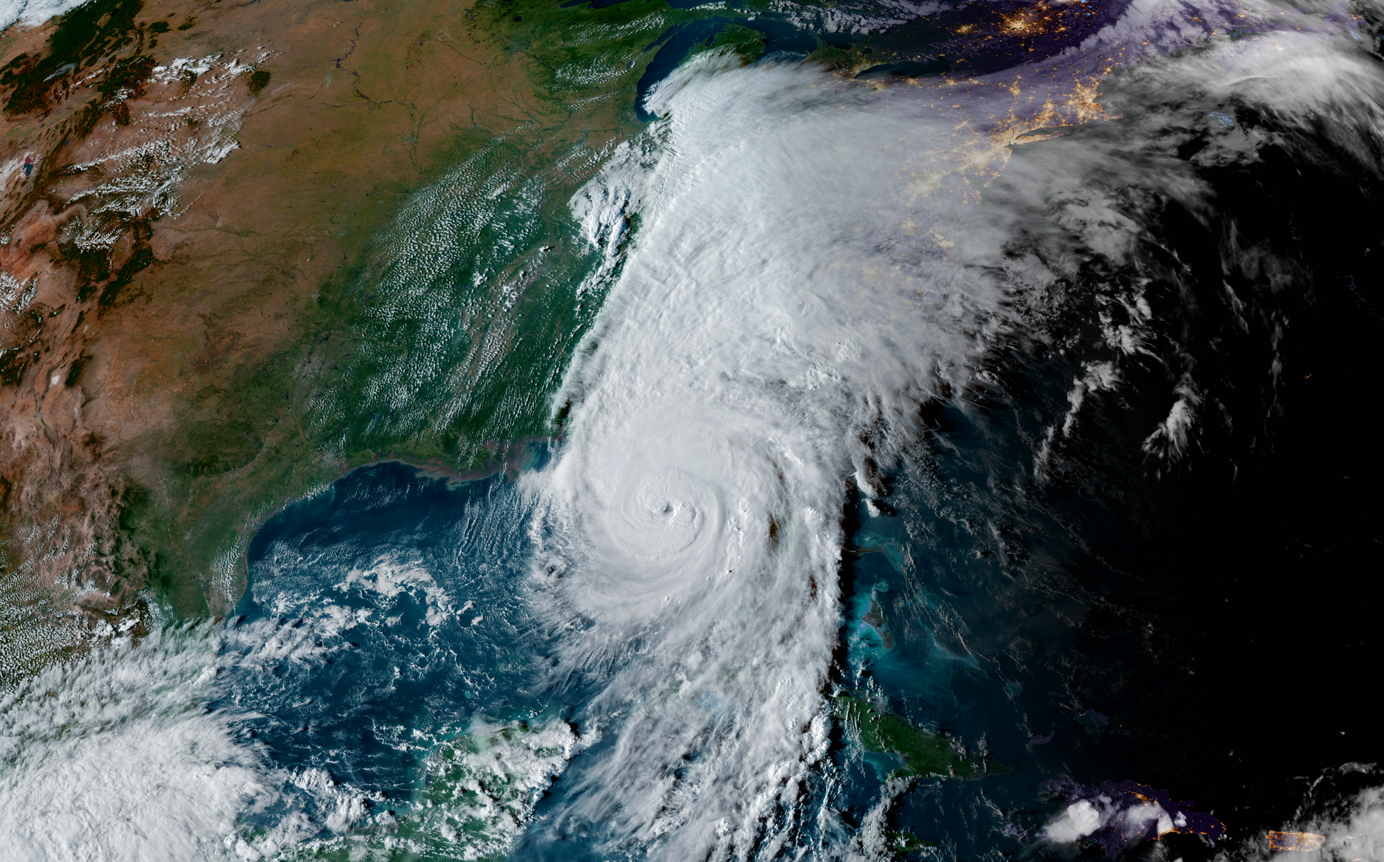
Even as Helene was 300 plus miles to our south, the moisture fetch from the Gulf into the Appalachians led to 6 - 12" rainfall totals BEFORE Helene arrived. This set the stage for flash flooding and record setting crest heights as tropical rainfall rates arrived Friday morning.
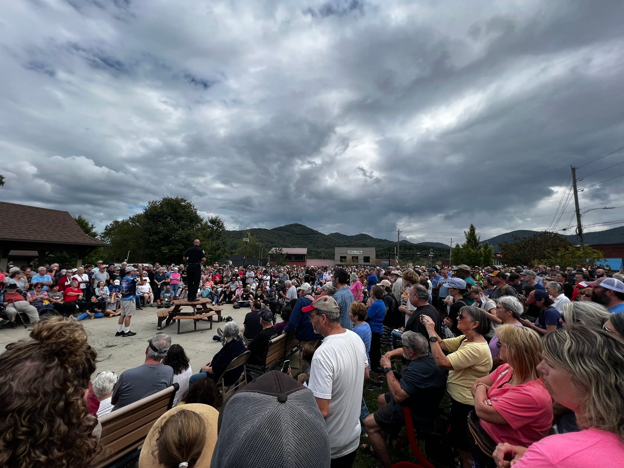
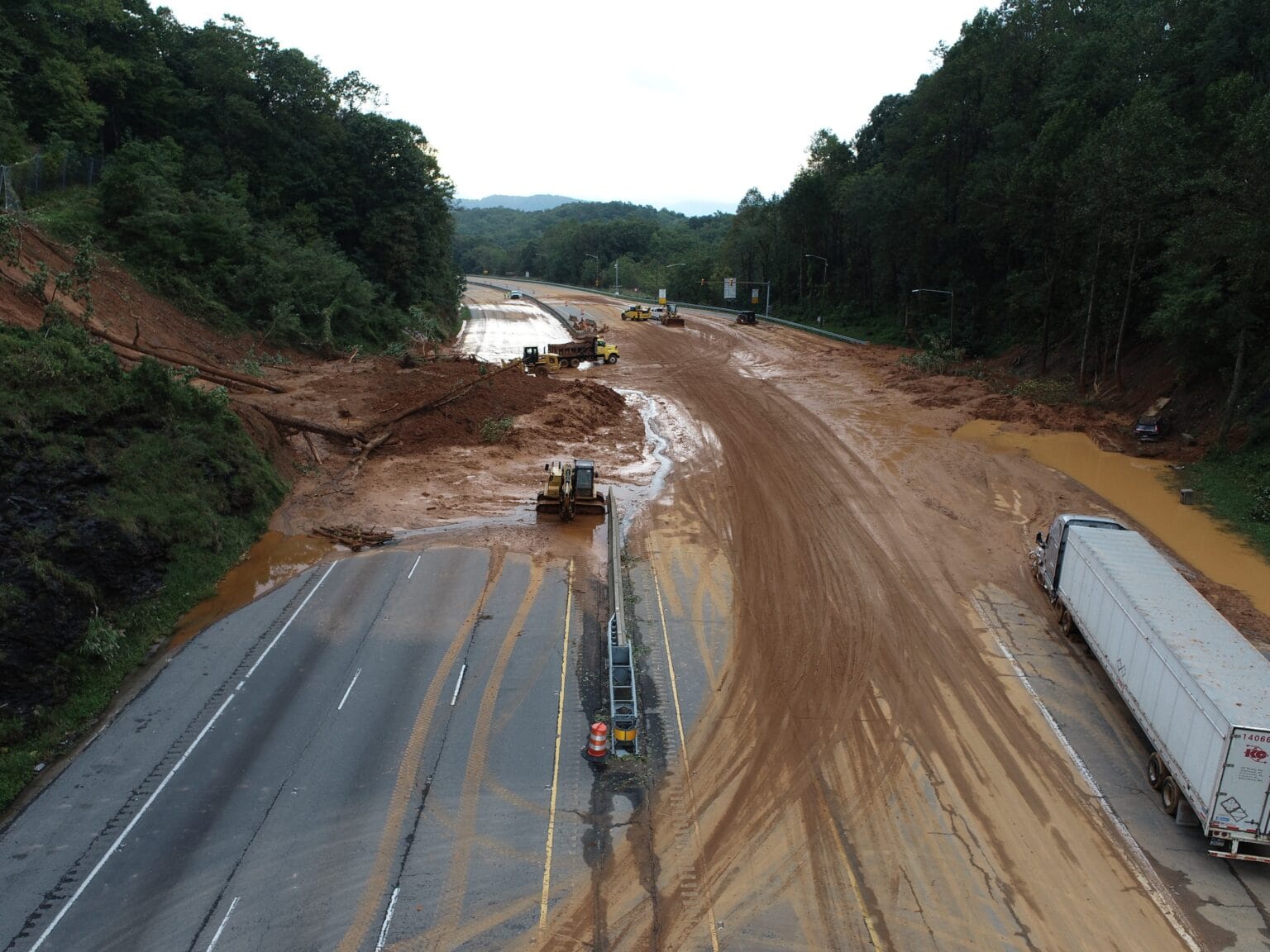
Evan Fisher @ Black Mtn Town Update / Landslide on I40, now open
Ways to Help
A list of organizations I recommend donating to or providing supplies to (see their websites for list of needs, changes daily) during these times of rescue and recovery. Feel free to email me additional organizations at info@parkwaycolors.com
Parkway is Closed
Closures began last Thursday morning and expanded to the entire Southern Section by the end of the day. No one is allowed on the Parkway, for any reason (according to NPS).
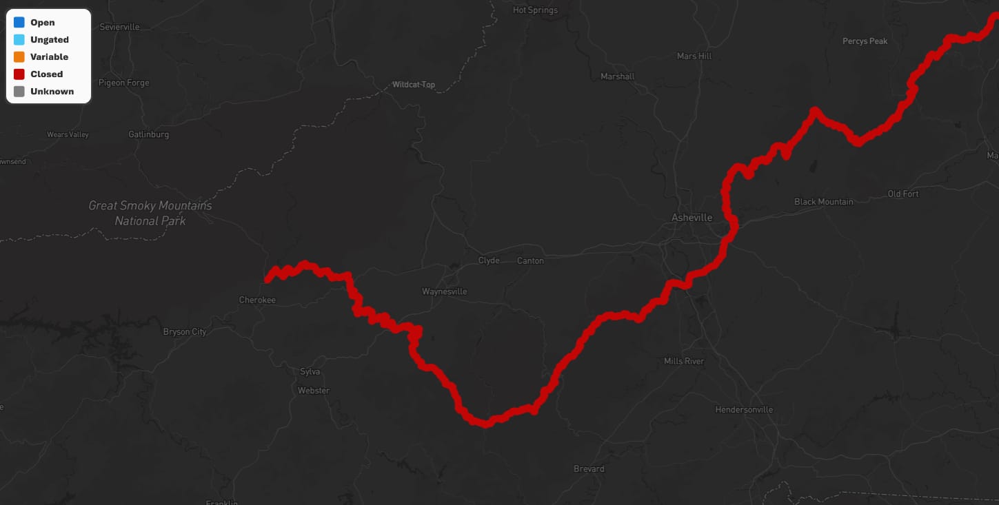
For How Long?
That is the multi-million dollar question. The Park service has no timeline on how long it will take to repair and restore sections where landslides occurred. Below are some of the first pictures from the Park Service.
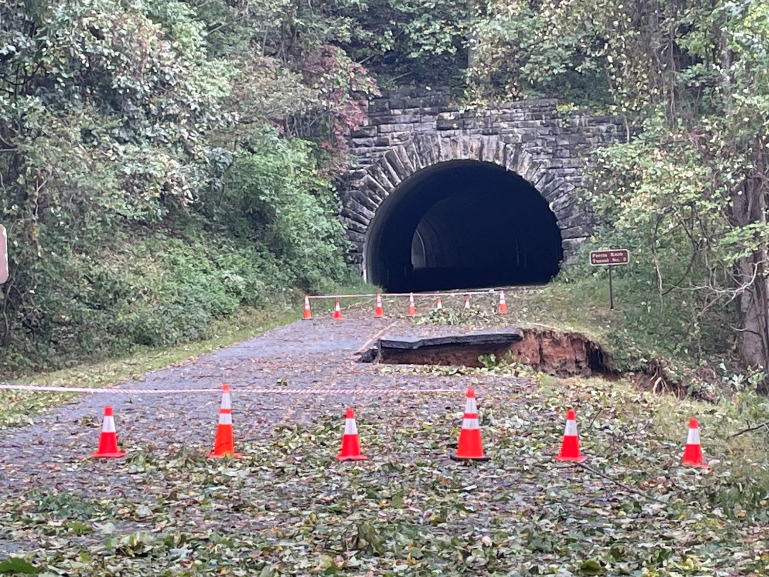
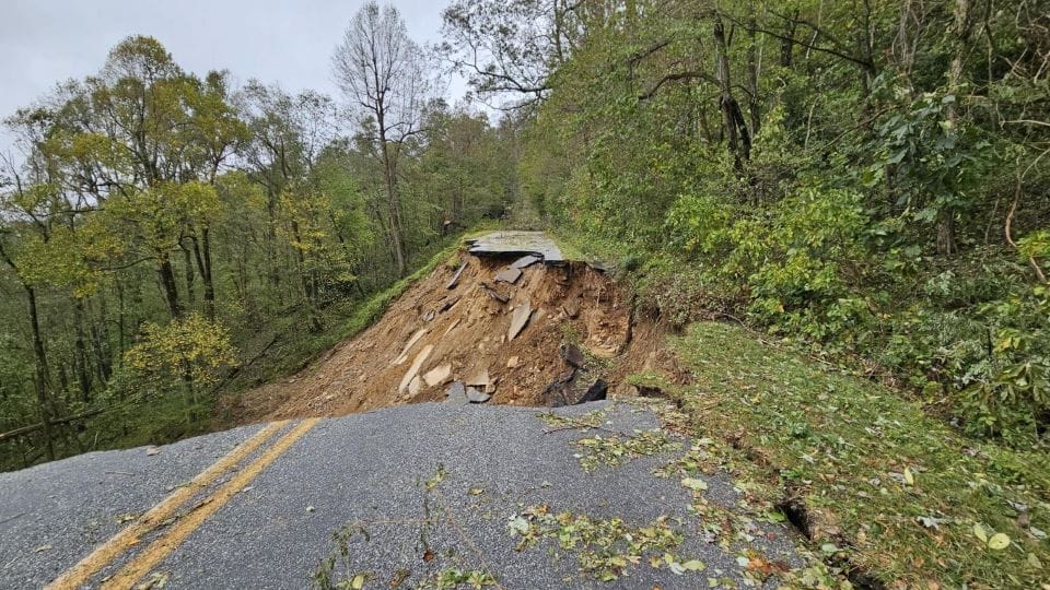
MP 336 / 375 / 401
Access to areas of the Parkway remains an issue, hence the need for more time to assess and develop a plan to rebuild/repair. It will likely take a long time.
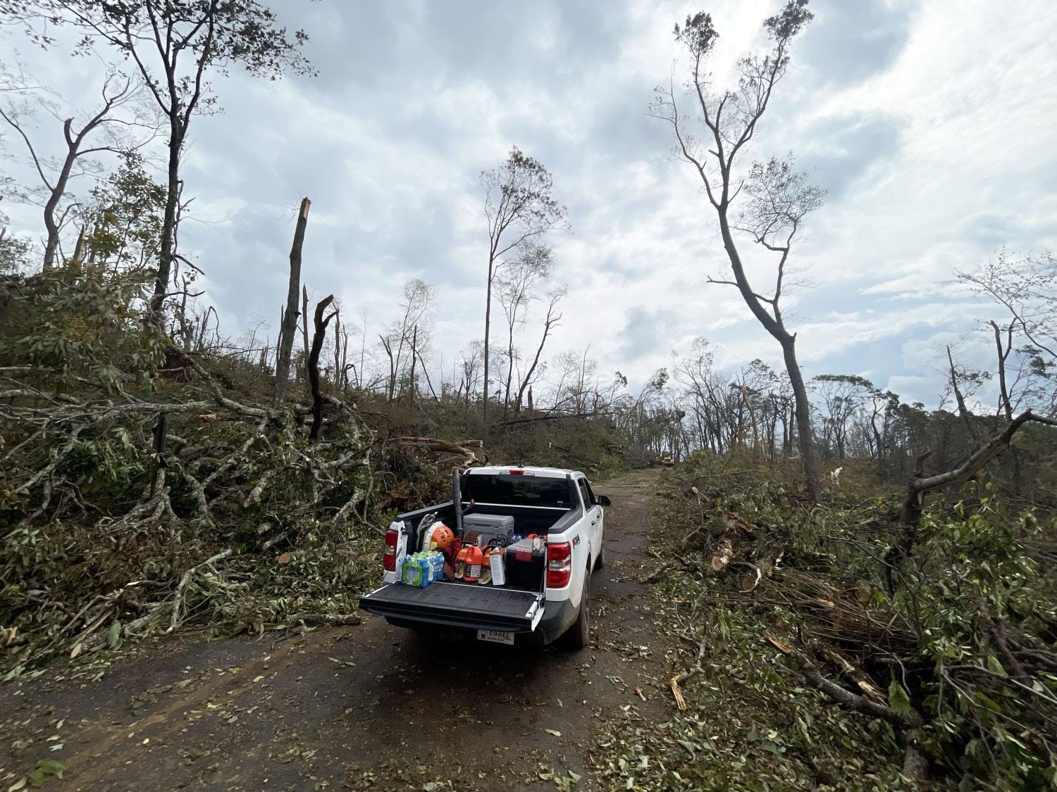
Our next question is how much color was lost due to the 60mph + gusts across the region, in addition to rainfall totals between 12 - 30". High - peak color areas are at a higher risk for strippage than low - mod color areas and my best guess is peak areas are stripped. From what I can see from the valleys, most of it survived.
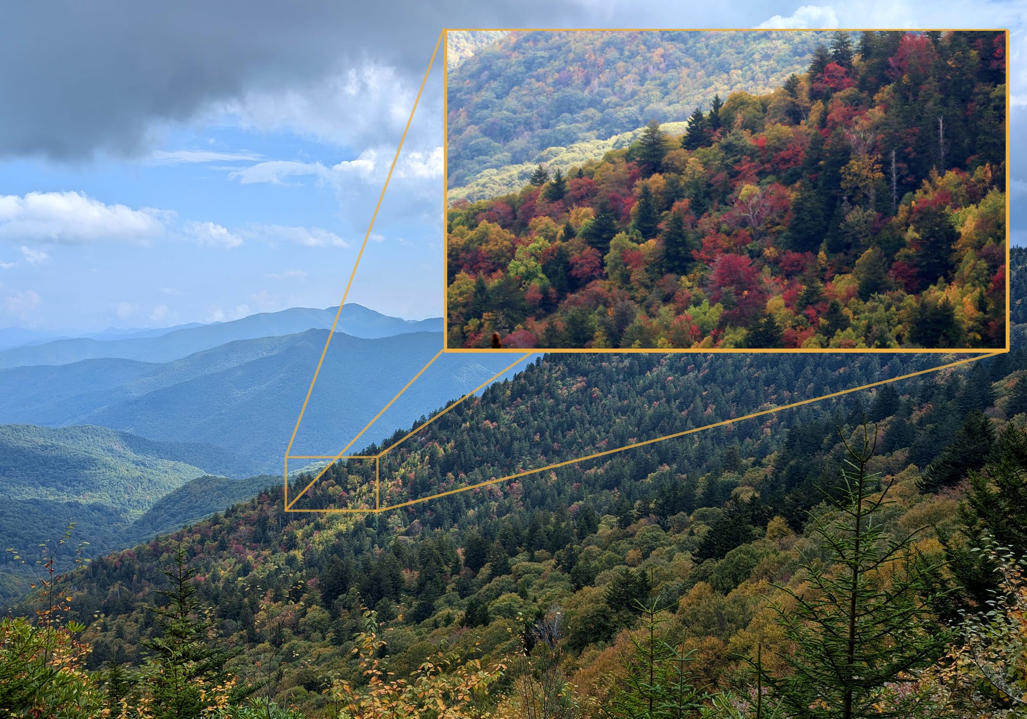
Past Peak: Graveyard Ridge
You read that right. We have our first observed Past Peak in the Southern Apps. Our best footage is mere seconds before it rained, showing past peak along Graveyard Ridgeline, while the southern hillside is at high - peak color.
Before panic sets in, this is normal and before Helene arrived, 95% of the region was at no color - mod color with plenty of season left.
Near Peak: Upper 215
Some folks love maples and their varying colors, others oaks and their late season turnover. And some like myself, LOVE our local Beech tree because each fall they transition to a bright and bold yellow-gold for a short time.
Helene's impact on these susceptible leaves (they drop rather quickly) is unknown. If they held strong, then peak color will occur between 10/2 - 10/5 across the Upper portion of Hwy 215 (currently closed from Helene).
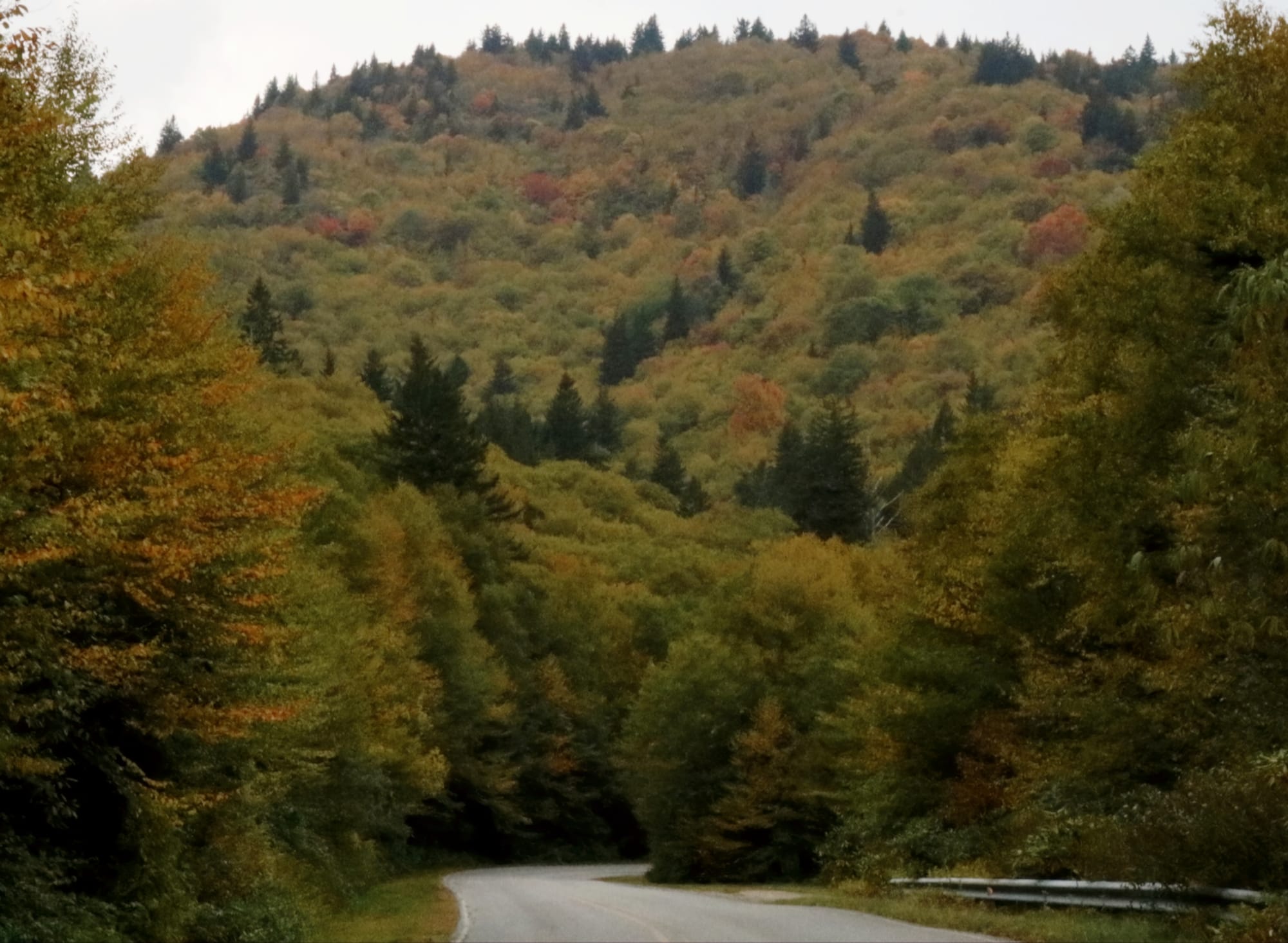
from Beech Gap down to below Little Sam Knob
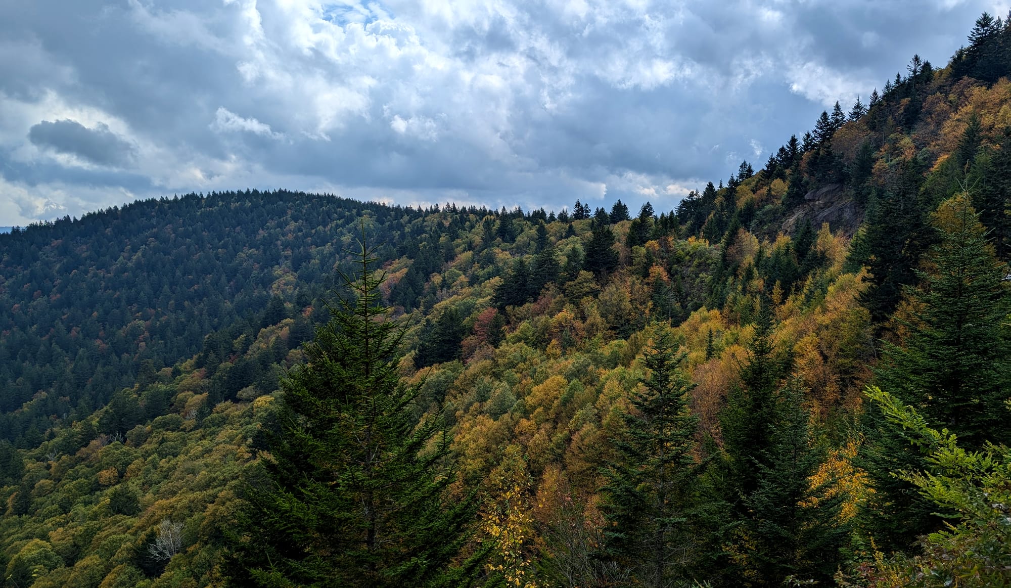
Mod Color: Beartrail Ridge
Another shaded area coming online with vibrant colors is the Big Beartrail Ridgeline that offers a view of Lake Logan (not in picture).
At this same spot (just in front of MP 430) you'll find high color as you come around the bend. This is highly localized and due to increased shade hours.
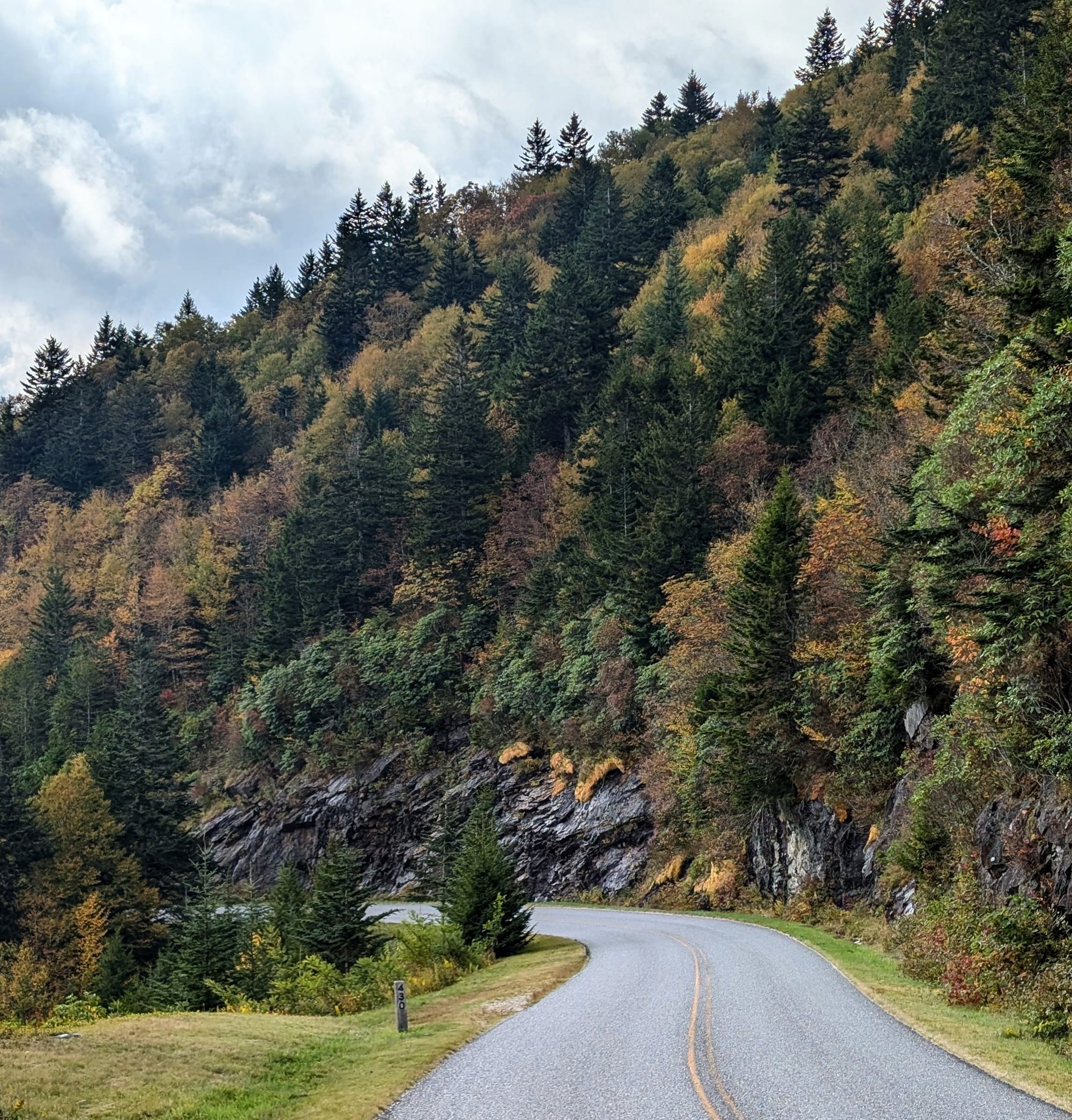
Right nearby is Little Beartrail Ridge, showing signs of mod - high color closer to the road, with less as you head out on the ridgeline.
Looking Ahead
With the Parkway closed for an indefinite amount of time, it may feel like the color season is lost but there are PLENTY of areas to visit to enjoy the fall season.
I will shift gears to cover these areas over the next few weeks, supporting our local economies west of the Asheville/Haywood area (the fall color season is likely a loss from Haywood to Ashe counties).
Stay safe out there and thank you for your patience in getting this report out. The last few days have been gut wrenching, but we'll continue to provide color reports this fall season alongside assisting in the cleanup and recovery from Helene.